

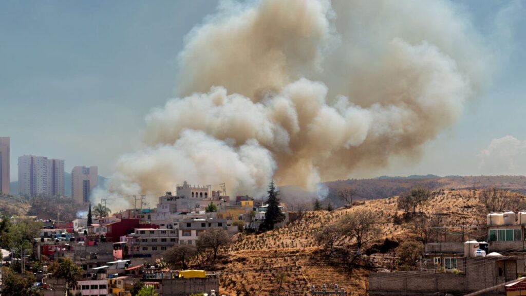
The season of forest fires in Canada showed a significant change in mid-July 2026. After a relatively mild start to the year, increasing temperatures and dry weather conditions drove the spread of the fire, generating plumes of smoke that crossed borders and reached several areas of Canadian and United States territory.
The phenomenon, which changed the visibility and color of the sky in several cities, highlights the importance of constant monitoring of atmospheric conditions. The dispersion of these pollutants, observed by advanced technologies, serves as a warning about public health risks in densely populated regions, especially when combined with persistent heat waves.
The dynamics of fire outbreaks
According to data from the Canadian Interagency Forest Fire Center, the country recorded around 850 active fires in mid-July 2026. The province of Ontario concentrated a significant portion of this activity, with more than 180 fires recorded, leading local authorities to issue evacuation orders in communities located in the northwest of the region.
Although the impact is visible and worrying, the total area consumed by fire, estimated at 1.9 million hectares since the beginning of 2026, remains significantly below the records observed in the years 2023 and 2025. The evolution of the season is still uncertain, directly depending on the continuity of meteorological conditions that favor or inhibit the spread of the flames.
Technology in satellite monitoring
Detailed recording of this event was possible thanks to the satellite sensor NOAA-21, which captured images on July 14, 2026. These captures made it possible to visualize the extent of the smoke clouds that moved predominantly to the southeast, covering parts of Quebec and reaching the Midwest and the American Northeast.
The use of satellite data is essential to understand the trajectory of atmospheric smoke and predict possible local impacts. The particulate matter carried by the winds altered the visual perception of the environment, leaving the Sun with orange tones and the sky with grayish nuances, highlighting the scale of the transport of pollutants over long distances.
Impacts on air quality and health
The severity of the effects of smoke on human health depends largely on the altitude at which the pollutants are found in the atmosphere. When smoke remains in high layers, impacts on air quality at ground level they are minimal, but the situation worsens when the plumes descend to lower layers of the atmosphere.
In cities like Toronto, the concentration of particulate matter reached levels considered unhealthy according to environmental monitoring data. This scenario was worsened by the presence of heat waves at the same time, creating additional challenges for risk management and the protection of groups more sensitive to respiratory problems.
Forecasts and future perspectives
Experts in North America continue to use forecast models to monitor the development of the fire season. Compiling data from agencies in different countries helps identify areas most likely to be at risk, allowing for a more coordinated response to climate variability.
Surveillance remains the main tool to mitigate damage, as the interaction between dry vegetation and climate is a determining factor in the severity of fires. What will happen during the remainder of the summer in the Northern Hemisphere will depend on climatic factors that continue to be monitored by scientists and specialized bodies.
Frequently asked questions about the phenomenon
- How smoke crosses borders Wind currents carry fire plumes to high altitudes, causing the smoke to travel thousands of kilometers beyond its source.
- What is the role of satellite monitoring? Orbital sensors make it possible to visualize the extent of clouds and predict the movement of pollutants, helping authorities issue health alerts.
- Why air quality varies The impact depends on the altitude of the smoke; if it falls close to the ground, the concentration of harmful particles increases, directly affecting the population's breathing.
- This is the worst season on record No, the data indicates that the total area burned by mid-2026 is well below the marks recorded in previous extreme years like 2023 and 2025.
Also read: US Air Force launches missile with autonomous drone.
Source and methodology
This article was prepared based on information published by science.nasa.gov, on July 16, 2026. See the original post: Ontario Wildfire Smoke Moves East. HTechBD reorganized and contextualized the data for the Brazilian public, without reproducing the source text.
Image: Jorge Romero no Pexels.
Continue lendo

The New Cycle of Weight Fluctuation with Obesity Medications
Entenda como a interrupção de tratamentos com GLP-1 pode criar um novo padrão de oscilação de peso, desafiando…

US Air Force launches missile with autonomous drone
A Força Aérea dos EUA testou com sucesso o disparo de um míssil a partir de um drone…

Three Decades of Dolly: What Cloning Science Has Achieved
Trinta anos após a ovelha Dolly, a clonagem evoluiu de promessa de ficção para uma ferramenta técnica complexa…